

This summer the University of Plymouth team where out collecting data along the south coast of Cornwall. The team collected sediment samples from the sea floor and information on the subsurface of the seafloor using a sub-bottom profiler. A sub-bottom profiler (SBP) is a type of sonar instrument that uses sound to map beneath the seafloor. It emits low-frequency pulses of sound towards the seafloor and records the signals reflected back towards the instrument.
Different types of substrates reflect sound differently, some allowing the signal to penetrate through the layers and some not. This enables scientist to identify and study the different layers of sediment, such as mud, sand, and rock, that lie beneath the seabed and estimate the thickness of each layer.
The data we collected will help us quantify how much sand is available offshore on the seafloor and can thus provide a potential sediment supply for the beach and dune systems along the Cornish coast. This data is essential for predicting how coastal systems will adapt to changing environmental conditions, sea-level rise and potential increased storm frequency.
-
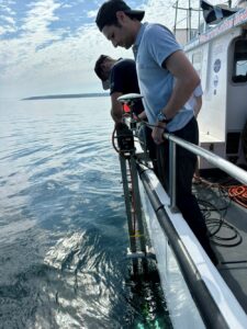
- Sea Bed Survey
-
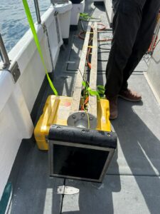
- Sub-bottom Profiler
-
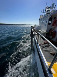
- Survey Boat


Making Space for Sand News and Events
We like to keep supporters of our project well informed of project progress and developments. We also want to share news of events which are happening and have happened and celebrate coastal community involvement.

Sign up to Making Space for Sand
If you would like to get involved in helping to make dunes more resilient and biodiverse, want to help develop coastal adaptation and emergency plans or just want to know more about what the project is learning about coastal change, please click here: