

Coastal sand dunes are Cornwall natural sea defences. In a single storm, coastal dunes can lose significant amount of sand, causing collapses along dune faces and leading to unstable, hazardous access to the beaches. The challenge has always been timing: will the next storm be the moment the dune gets eroded? Therefore, our project partners University of Plymouth, are building a fast, reliable dune-erosion forecasting model to answer this question—piloted in Penhale, one of Cornwall’s most dynamic dune systems.
The idea is simple: learn from the past to prepare for tomorrow. We start with a complex coastal process model (XBeach) and tune it carefully using measurements taken after the past winter storms, when the dune severely eroded in Penhale. Once we are confident the simulated erosion matches what was observed in the field, we run a whole “library” of realistic storm scenarios that span different energetic wave conditions and water levels. Each scenario tells us how much sand that the dune would likely lose, and together the model outputs map out the dune response across different magnitude of storms. The result is a lightweight forecasting tool that can take an incoming five-day wave and tide forecast and quickly translate it into clear estimates of expected erosion.
Why Penhale?
Long-term beach surveys in the area and insights into how these dunes has changed over time give us a complete picture of how the system behaves in the past. That evidence makes our forecasts more grounded and useful. The finished model will plug into the South West coastal flood early-warning system developed by the University of Plymouth’s Coastal Processes Research Group (SWEEP-OWWL; https://coastalmonitoring.org/ccoresources/sweep/). That integration means site-specific alerts can appear alongside flood guidance already used by local authorities and beach managers. The aim is practical: clearer early warnings, safer access decisions, and better timing for inspections.
This is just the start
The same approach can be adapted to other natural dune systems across the South West. As we fold in more monitoring data and continue to test against real events, the forecasts can be implemented for other beaches. For communities living behind the dunes, that means clearer early warnings, so people know not to go near dune faces or access points when the storm is on the way.
-
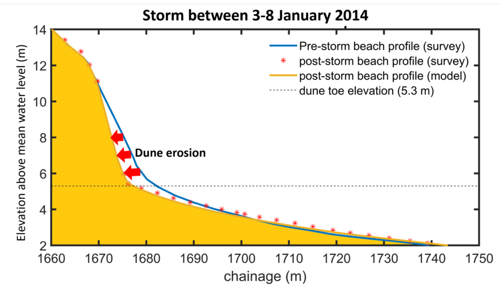
- Storm Erosion Modelling
-
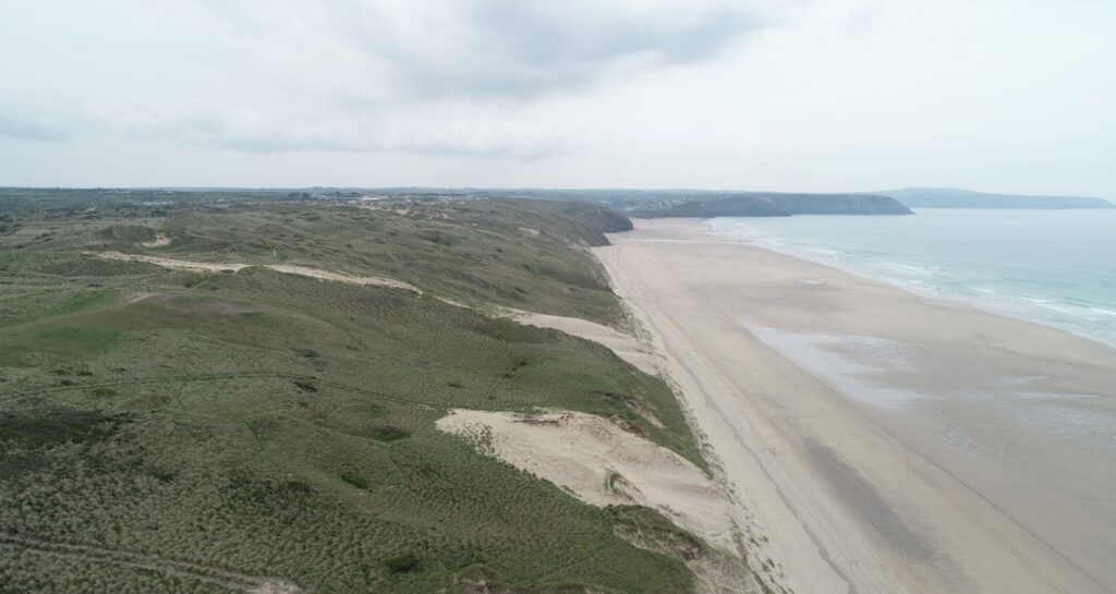
- Penhale dune from the north


Making Space for Sand News and Events
We like to keep supporters of our project well informed of project progress and developments. We also want to share news of events which are happening and have happened and celebrate coastal community involvement.
Sign up to Making Space for Sand
If you would like to get involved in helping to make dunes more resilient and biodiverse, want to help develop coastal adaptation and emergency plans or just want to know more about what the project is learning about coastal change, please click here: